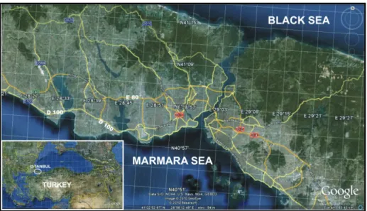
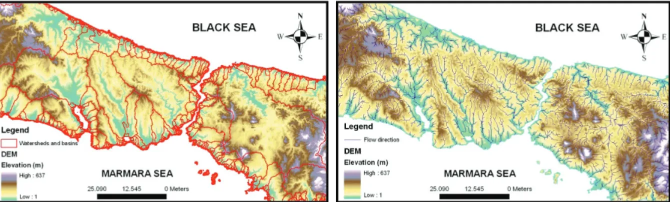
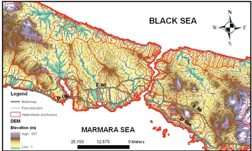
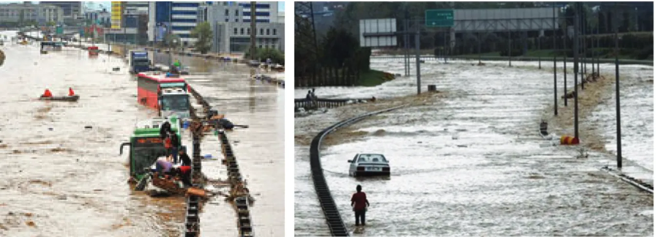
Başlık: Flashfloods and Floods in Istanbul Yazar(lar):TUROĞLU, Hüseyin Cilt: 3 Sayı: 1 Sayfa: 039-046 DOI: 10.1501/Csaum_0000000043 Yayın Tarihi: 2011 PDF
Tam metin
Şekil
Benzer Belgeler
The ethyl acetate and ethanol extracts inhibited all of the Gram-negative bacteria, including the multi- antibiotic resistant strains of S.. The chloroform extract inhibited
Our inter-domain traffic engineering architecture has 3 major components: Inter-domain QoS routing protocol, bandwidth brokers (BB) and traffic engineering extended
Şubat 2016’da atanan ve adaylık eğitiminin ilk altı ayını atandıkları ilden farklı bir ilde tamamlayan aday öğretmenlerin çeşitli deneyimlerinin ve adaylık
In this context, the quality of the teaching staff, each with a well-established academic school, as well as the richness and depth of the programs of the graduate programs and
Iraksak geçerliğe ilişkin elde edilen diğer bulgular, Antrenör Kaynaklı Destekleyici ve Kısıtlayıcı Güdüsel İklim Ölçeği’nin destekleyici alt boyutunda bulunan
Sonuç olarak; gebelik döneminde toksop- lazma enfeksiyonu kazanımı ve fetüse geçiş önemli derecede önlenebilir bir durumdur fakat toksoplazmoz epide- miyolojisi, tanı-tedavisi
Polonya edebiyatında çok önemli bir yere sahip olan, hatta Polonya’nın bugüne değin en büyük yurtsever şairi olarak kabul edilen Adam Mickiewicz de söz
federasyonun belirli yetkilere sahip olması gereği idi. Aksi takdirde, federasyonun çalışması mümkün olmazdı. Bu listede yer almayan konular, federe devletlere
