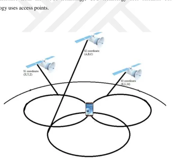
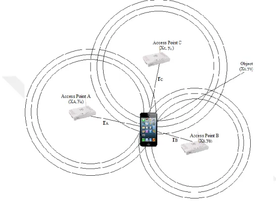
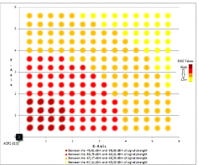
Indoor positioning system development / triangulation algorithm with least square method
Tam metin
Şekil

Benzer Belgeler
Rıza Tevfik’in Sanat ve Düşünce Dünyası adlı bu kitap Abdullah Uçman’ın 1982’den 2010 yılına kadar Rıza Tevfik üzerine kaleme aldığı çalışmalardan
Bu araştırmada ekran başında şekerli içecek tüketen adölesanların günlük şekerli içecek tüketim miktarı istatiksel olarak anlamlı düzeyde daha fazladır
In this context, we systematically studied blood compatibility of mesoporous silica nanoparticles possessing ionic, hydrophobic or polar surface functional groups, in terms of
Merhum Şeyhülharem Müşir Hacı Emin Fasa ahfadın dan, merhum Salih Zeki Paşanın ve merhum Ali Kırat Paşanın torunu, merhum Albav Emin Sargut’un ve
Çünkü toplumsal ezil mişlik, artı kadın, toplumsal ezil mişlik artı çocuk, toplumsal ezil mişlik artı gençlik, yani iki ezil mişlikler daha çok ilgimi
6 This lacuna stems from the fact that the existing general literature suffers from the pitfalls of state-centralism in that studies focusing on immigration control and
Sayısal hesaplarda, Monte Carlo yöntemi uygulanarak elastisite modülünün uzunluk bileşenine rastgele değerler verilerek doğal titreşim frekansı için bulunan her üç ifadede
Eğitim planlaması alanında en belirgin yenilik; planlamalarda eğitimin etik, sosyoiojik ve küitürei yönlerine daha fazla önem veril meye başlanmasıdır. Oysa,
