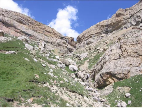
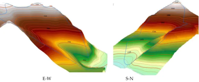
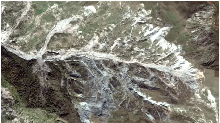
The Transformatıons Of Slope Slıde Landscapes Of Great Caucasus: Possıbılıtıes Of Dıscoverıng Of Maın Factors
Tam metin
Şekil

Benzer Belgeler
Ancak, Marx toplumsal alanda ortaya çıkan tüm ahlaki, politik ya da hukuki problemlerin kökenini üretim ilişkileri alanında bulurken, çatışma yaratan
Based on the findings estimated, the New Zealand’s government could consider following issues for policymaking in case of the real exchange rate: (i) there are
Bilimsel bir araştır- ma, daha önce hareketsiz bir yaşam sürseler bile, 60 yaşı geçtikten sonra haftada üç gün yalnızca 45 dakika tem- polu bir yürüyüş yapanların,
Başkan ve arkadaşlarının RA’lı hastalarda cinsiyet, hastalık aktivite kriterleri, fonksiyonel ve psikolojik durum arasındaki ilişkiyi inceledikleri çalışmalarında, RA’lı
Researchers are trying to examine and analyze trends in the volume-spatial and architecturally-art decisions of the Ukrainian and Russian Baroque, exploring the
During the investigation the health status of workers in the main occupations of titanium-magnesium production, the connection between clinical and X-ray functional changes
Behçet Uz Çocuk Hastalıkları ve Cerrahisi Eğitim ve Araştırma Hastanesi, Çocuk Sağlığı ve Hastalıkları Kliniği, İzmir, Türkiye..
Daha önce vajinal doğum tecrübesi olan kadınların % 20,2’sinin mevcut gebeliğinde sezaryen doğum istemesinin ne- denlerine bakıldığında ise kötü vajinal doğum tecrü-
