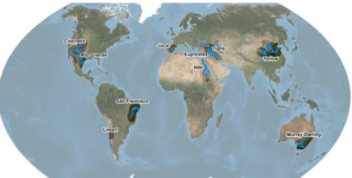
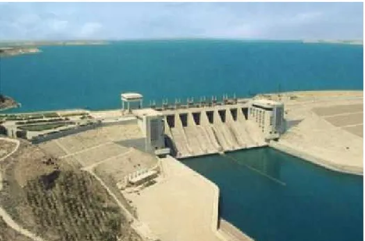
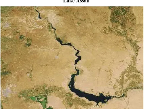
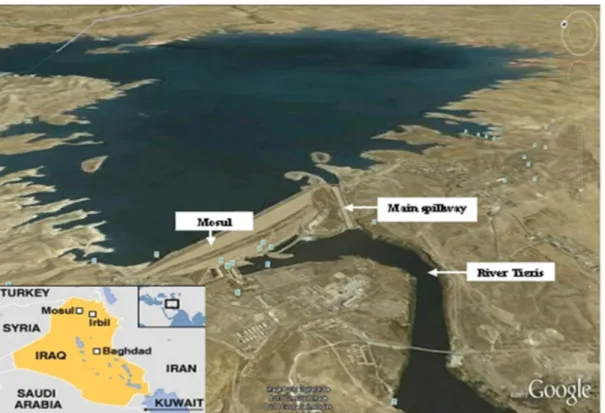
Sustainability of engineered rivers in arid lands: Euphrates-Tigris and Rio Grande/Bravo
Tam metin
Şekil


Benzer Belgeler
Üreter taşının endoskopik tedavisi sırasında aynı taraf renal ünitede bulunan alt kalis taşı da RİRC ile başarıyla tedavi edilebilir. Retrograd intrarenal cerrahi
S3.Üstteki sayının en yakın olduğu onluğu boyayalım. Birler basamağı 5' ten küçükse kendi onluğunda kal, 5'ten büyükse bir sonraki onluğa git….. S9. M
Bu varsayımlar çerçevesinde Tablo 4’te kore- lasyon analiz sonuçları incelendiğinde, ekonomiklik boyutu ile kurumsal iletişim, kurumsal davranış ve algılanan kurumsal
Organochlorine pesticides (OCPs), polychlorinated biphenyls (PCBs), polycyclic aromatic hydrocarbons (PAHs) and aliphatic hydrocarbons (TALI) were determined in fourteen
Annenin ve bebeğin serum vitamin D düzeyi ile bebeğin persantilleri arasındaki ilişki, D vitamini eksikliği olan annelerin bebeklerinde bu eksikliğin yansımaları
Tablo 15: Dünya Gelir Düzeyi lngw Değişkenine Ait Birinci Fark Birim Kök Testi Sonuçları Yatay Kesit 14.. Yöntem Im, Pesaran,
Türkiye’de son on yılda saptanan santral sinir sistemi enfeksiyonlarında viral etkenlerin değerlendirilmesi ve bibliyometrik analizi.. Turk Mikrobiyol
Kinetik beyin egzersizi programının, 9-10 yaş grubu erkek çocuklarda, motor beceri, koordinasyon, dikkat, reaksiyon süresi, denge ve akademik başarıları üzerine
