REPAIR PHASES OF SULEYMANIYE COMPLEX IN DAMASCUS METU JFA 2018/2 1
INTRODUCTION
Suleymaniye Complex which was commissioned by Sultan Suleiman the Magnificent (1495–1566) on the pilgrimage route from Istanbul to Mecca, on the bank of the River Barada as the last stop before the desert is one of the monuments designed by Mimar Sinan in accordance with the principles of the Ottoman classical period. “Takiyah Suleymaniye” was built between 1554 and 1559 on the site that was once occupied by the palace outside the walls of Damascus commissioned by Memluk ruler Baibars in 1264. It is composed of the Mosque, two Tabhanes (hospices), Caravanserais, the
Imaret (public soup kitchen), the Madrasa and the Arasta (bazaar) (Kuran,
1986, 69; Necipoğlu, 2005, 222-30) (Figure 1).
This paper (1) aims to study the construction and restoration phases of the Complex in chronologically ordered periods by associating the historical documents and researches with the findings and traces in the building (Şahin Güçhan and Kuleli, 2009). While the evaluations on the restorations and interventions in the building during the first four periods are based on the limited written and visual documents, the findings and evaluations on the situation in 2005 are derived from the authors’ observations in the site and the reports prepared by Syrian and Turkish specialists. It is anticipated that this study would be useful in tracking the changes in the building from its planning in 1554 by Mimar Sinan until present as well as understanding the construction and intervention processes in different periods.
Location and Relationship with the City
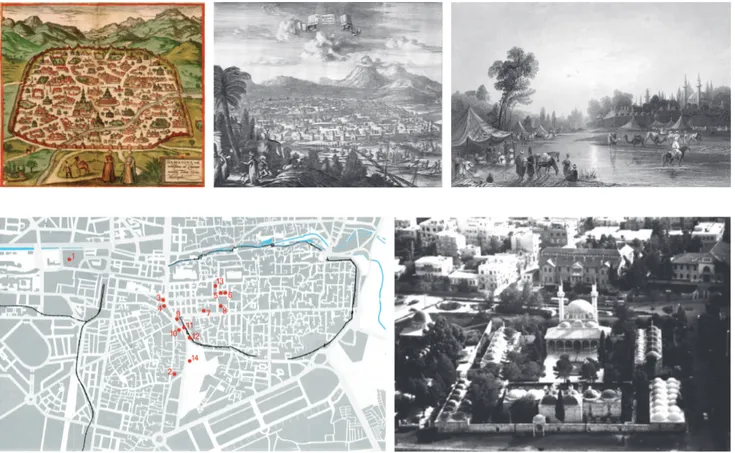
The city of Damascus, one of the five biggest cities of the Ottoman Empire where they have built many monuments from 1516 to 1918 (Kafesçioğlu, 1999, 70-96; Raymond, 1995, 26; Van Leeuwen, 1999, 192-203). As indicated in Braun and Hogenberg’s map of 1575, the domed building in the map drawn with two minarets in a courtyard outside the Damascus Walls at the bank of the River Barada should be Suleymaniye Mosque (Figures 1-5).
REPAIR PHASES OF SULEYMANIYE COMPLEX IN
DAMASCUS
Neriman ŞAHİN GÜÇHAN*, Ayşe Esin KULELİ**
Received: 09.02.2016; Final Text: 03.11.2017 Keywords: Süleymaniye Complex in Damascus; Mimar Sinan; Ottoman; restoration.
1. The first version of this paper was delivered in the Sinan & His Age Symposium but not published. The second version of the study is published as sections of a book written by the authors and published in 2009. Then this concise and revised version of the article is written in English in 2016 with the addition of some new findings. For more information on evidence, documents and opinions see: (Şahin Güçhan and Kuleli, 2009).
* Graduate Program in Conservation of Cultural Heritage, Faculty of Architecture, Department of Architecture, Ankara,
TURKEY.
** Department of Architecture, Faculty of Fine Arts and Architecture, Antalya Bilim University, Antalya, TURKEY.
DOI: 10.4305/METU.JFA.2018.2.3 METU JFA 2018/2
As the local scholar al-Almawi (2) states, the garden of the mosque which is abundant in fruit trees stands as practically an oasis at the entrance of Damascus.
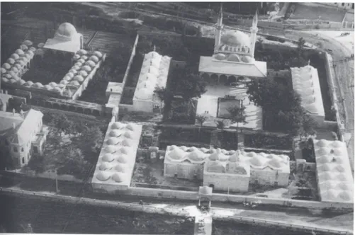
In Olfert Dapper’s engraving dated to 1667 caravans and travellers bathing in the River Barada are illustrated. At the left bottom corner of the engraving, the arched gate of Kulliyah and behind it Suleymaniye Mosque with a single dome are seen (Figure 2). The account of Evliya Çelebi (Dağlı et.al., 2005) who visited Damascus in 1648/1649 (1058 AH) on life around the Kulliyah and its environs comply with Dapper’s representation. W. H. Bartlett’s engraving from 1836 depicts caravans and tents of
travellers lodging in the bank of the River Barada (Figure 3). Caravans are passing through the River which seems very shallow and does not have bridge on it. In the right backside, the Takiyah seems like an oasis. The Suleymaniye Mosque with its two sultan minarets is an important element forming the extramural silhouette of Damascus.
In a photograph which was shot in 1868 right after a flood destroyed the bridge on Barada, a demolished wall is seen in the riverside (Figure 6a). In another photograph taken from the same spot, the wall near the riverside of Barada is missing (Figure 6b); the door of the main courtyard of the Complex is renovated and elevated; a building mass is added next to the entrance; the courtyard wall is extended so as to surround the Tabhane and the graveyard; the long trees in the courtyard are pruned. A new door is added to the western part of the Caravanserai which is located near the riverside. There is not a bridge on Barada. In another photograph which is dated to the years between 1890 and 1900, it can be seen that walls are built Figure 1. Damascus in 1575, Braun and
Hogenberg, 1575, Civitates Orbis Terrarum, map II-55.
Figure 2. Damascus in 1667, Olfert Dapper, 1677 (1st Ed.). “Naukeurige beschryving
vangantsch Syrie, en Palestyn of Heilige Lant...”, Jacob van Meurs, Amsterdam:17). Figure 3. DSC, view from north-west, drawing by W. H. Bartlett, 1836. Figure 4. Ottoman monuments built in Damascus in 16th century (Şahin Güçhan &
Kuleli, 2009, 12).
Figure 5 DSC; view from north, (The Archive of Syrian Ministry of Culture).
REPAIR PHASES OF SULEYMANIYE COMPLEX IN DAMASCUS METU JFA 2018/2 3
in the both sides of the river and a bridge is added opposite to the northern entrance of the Complex (Figure 6c).
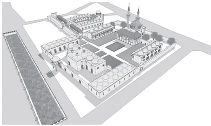
The map of Damascus prepared by French in 1929 also confirms what A. Raymond (1995, 147) suggests for Damascus that the city’ asymmetric extramural growth started in the first quarter of the 20th century (Figure 7). Starting by 1929, the new settlement areas expanded from Saroujah
district to North-West covering the skirts of the Mount Qasioun in an arch shape. On the other hand, the urban growth in the western bank of the city, which housed the administrative and cultural buildings including the Suleymaniye Complex, was relatively slower. According to this French map (Figure 7), the urban fabric of Damascus has changed in the beginning of the 20th century; the Suleymaniye Complex has remained as a cultural
centre and a new administrative quarter has emerged around it (Figure 5,
13).
THE CONSTRUCTION PHASES OF THE COMPLEX First Phase: Süleymaniye Complex in Damascus
Damascus Suleymaniye Complex which is attributed to Mimar Sinan by Evliya Çelebi is contemporaneous with the Suleymaniye Complex in Istanbul. The plan scheme of the complex which was built on the flatland on the bank of Barada River is composed of a rectangular courtyard that is surrounded with the Mosque and the Imaret on the two longer sides and the Hospice and Caravanserai symmetrically located on the two short sides. The complex is oriented in the east-west axis and on the eastern end of the entrance an Arasta and to the south of it a Madrasa with courtyard are located (Figure 9- 11).
Kuran (1988, 169-75; 1986, 69-70) states that the Complex was established in two phases: the first part of the Complex which includes the Mosque and the Imaret was built during the reign of Suleyman the Magnificent; the second part composed of the Madrasa and the Arasta, which are recorded in Tuhfet ül-Mimarin, was built during the reign of Selim II. He also adds that Mimar Sinan as the chief architect might have ordered one of his assistants to build the Complex whereas the Selimiye Madrasa located in the east of the Complex might have been built by a local architect. This view is consistent with the organization and working scheme of the Hassa (Royal) Architects (Turan, 1963, 13).
Necipoğlu (2005, 226), who points out to the misinterpretation about the architect of the Suleymaniye Complex in reference to Al-Almawi, states that a Persian named Mawlana Mullah Aga Al-Azami (Ajami), the first Arabic spaeking Hanafi Muftu and the director of the pious foundation is Figure 6. a) DSC, 1868 (?); view from River
Barada (north-west). [http://en.wikipedia. org/wiki/Barada], © Wikimedia Commons. Access Date (23.04.2009). b) DSC after renovation, probably between 1868-1890. [http://wowturkey.com/forum/viewtopic. php?t=17977&start=85]. Access Date (09.05.2009). c) River Barada, 1890-1900. [http://www.old-picture.com/europe/stream-Barada-The-of.htm]. Access Date (09.05.2009).
the construction inspector of the Selimiye Madrasa, but not the Complex and arrived at Damascus right before the end of the construction. Another construction inspector named Mustafa was assigned temporarily on behalf of Mullah Aga Al-Azami but soon he returned to his office and then expanded the Complex and made amendments in the contract of the pious foundation in accordance with the new conditions. According to Necipoğlu (2005, 226), Mimar Sinan who built the Suleymaniye Complex (1550-6) in a harsh topography within the dense urban fabric of Istanbul must have seen the construction site of the Complex to be built in Damascus. Because when Figure 7. Damas 1929, Prepared by: Bureau
Topographique des Troupes Françaises du Levant (T.F.L.), Publisher: Service Géographique de l’Armée, Date: January, 1929, Scale: 1:10,000, Paris. [http://historic-cities.huji.ac.il/syria/damascus/maps/tfl_1929_ damascus.html]. Access Date (15.11.2005).
REPAIR PHASES OF SULEYMANIYE COMPLEX IN DAMASCUS METU JFA 2018/2 5
Selim I, Sultan Suleyman’s father have moved to Ablaq Palace on the bank of the Barada River and set his military base in the Green Maidan (Maidan Al-Akhdar) Sinan was serving in the Janissary Army. Thus, designing the Damascene Complex on a flatland was easier in comparison to its contemporaneous in Istanbul.
On the basis of a record in dated to 1553 in the Suleymaniye Complex Cadastral Registers edited by Barkan, Necipoğlu (2005, 225-6) also states that Mimar Sinan may have send one of his assistants Muslihuddin to Damascus with the drawings he drew himself. According to her, Muslihuddin stayed more than a month in Damascus and worked in the construction of the Complex together with other architects and masons. Necipoğlu (2005) who claims that the architect of the Complex was a non-Muslim named Theodoros basing on a record dated to 1560 agrees with Turan on the possibility of the local architects assigned by the Chief-Architect to work in the building projects outside the centre. Dündar (2005) in his research on the Registers of Important Decisions (Ahkâm-ı Figure 8. DSC; view from north (Kuran, 1986,
69).
Figure 9. Site plan of DSC, (Şahin Güçhan & Kuleli, 2009, 31).
Kuyûd-ı Mühimme), a 16th century Ottoman Archive including information
on the Ottoman architects, worked in building projects in Syria states that Theodoros is the architect of the Complex and adds:
“Theodoros (in the records, Todoros) is the architect of the Damascus Suleymaniye Complex which is named as “İmâret-i Amire” (Imperial Soup Kitchen) in the registry. In a letter addressed to the Sublime Porte, the Governor of Damascus informs that Theodoros had fulfilled his duty and successfully completed the construction of the Complex. In response, the Sublime Porte assigns Theodoros as an architect with a wage of unspecified amount in Ramadan 23rd, 967 (June 17th, 1559). However it is not clear if
Theodoros was summoned to Istanbul or allowed to work in Damascus. Besides, there is no information in the records on the other buildings that Theodoros worked in or the date of his death.”
In this regard, it is known that Şemsi Ahmed (Şemsi Pasha) who was appointed to Damascus governorship by Sultan Suleyman inspected the construction of the Complex and prepared the inscription panel of the Mosque on which the date of the completion of the construction is recorded as 1558-59 (Necipoğlu, 2005, 225). It can be deduced from the views of the historians that even if Theodoros was on duty as an architect in 1554 when the construction began is obscure; it is known the Suleymaniye Complex in Damascus was built in accordance with the design of Mimar Sinan with the local support.
Ertaş (2000) mentions the Damascus earthquake of 1759 which heavily destroyed the Suleymaniye and Selimiye complexes alongside many building in the city. However, the Selimiye Complex that the author identifies is the Tomb of Ibn al-Arabi, but not the building that served as a part of the Suleymaniye Complex and named as Madrasa Selimiye in certain sources.
The Second Phase: Addition of the Madrasa
Kuran (1988, 169-170), in reference to Tuhfet ül-Mi’marin, states that the Madrasa added to the Complex “was formed by a high domed classroom and twenty-two student rooms placed around an arcaded courtyard... the open arasta containing forty-four shops was located in front of the Madrasa” (Figure 9-11). The author is certain that the buildings he defined as the first part of the Suleymaniye Complex were designed by Sinan as they are registered in Tezkiret ül-Bünyan, Tezkiret ül-Ebniye ve Tuhfet ül-Mi’marin. However, because of the stylistic differences of the Madrasa and Arasta he suggests these buildings were planned by another architect. Figure 10. Ground floor plan of DSC, (Şahin
Güçhan & Kuleli, 2009, 32).
Figure 11. 3D images of DSC, (Şahin Güçhan & Kuleli, 2009, 34-35).
There are certain confusions in appellation of Madrasa and Arasta that Kuran defines as the second part of the Suleymaniye Complex both in the earlier sources and daily usage (3). This confusion has continued during when Damascus was under French control (1918-1946). In a French map dated to 1929, the building was named as Sultan Selim with the registry number 21 (Figure 7). The reason for this confusion is that there are two distinct building complexes of different eras; one from the reign of Sultan Selim (1512-1520) and the other is from Sultan Selim II (1566-1574).
The first Ottoman building ever built in Damascus is Ibn al Arabi Complex which was miscalled as Selimiye Complex by many authors. This complex was established upon request of Sultan Selim by adding of a mosque and a public refectory near the Tomb of Ibn Al Arabi which was located in the north-west of city walls, in Salihiya district to the south of Mount Casion (Kafeşçioğlu, 1999, 74; Necipoğlu, 2005, 223-4; Van Leeuwen 1999, 95-100; Yüksel, 1983, 447-48).
The construction of the Madrasa and the Arasta adjacent to the eastern side of the Suleymaniye Complex was started during the reign of Suleyman the Magnificent but because it was completed later in 1566 during the reign of Selim II, the building became known as Selimiye after the new sultan (Kafesçioğlu, 1999, 95; Van Leeuven, 1999, 98).
Although erroneous in many points, the definitions and arguments of Wulzinger and Watzinger (1924) raises certain questions: The authors who investigated the existence of a building complex on the site of the Madrasa most probably confused this building with Ibn al Arabi Complex. However, the statements of Wulzinger and Watzinger (1924, 112-4) about the upper floor of the Arasta in 1924 draw attention:
“...As a result of excessive use, the East-West street became the market street; there were domed cubicles (hanut) and presently demolished upper floor rooms (tebak) were located oppositely in the area stretching from the eastern gate of the Takiyah of Suleyman to its monumental gate (E). At the part where the two takiyahs adjoined there is a lavatory the water to which was brought from Banyas (Bereda/Barada?) via an arch upon the separating wall...”
The descriptions about the demolished upper floor of the Arasta that became the market alley and location of lavatories placed in the open area between the Madrasa and Tabhane rooms and accessible from the place where the Complex and the Arasta adjoin are important for understanding the changes in the Complex. As described in detail below, there is some information in records suggesting that the Arasta was once two-floored. In addition to that, Ertaş (2000) reveals that the Suleymaniye Complex was partially demolished in the Damascus earthquake in 1759.
The Third Phase: Addition of a Dervish Lodge to the Complex
It is written in Necipoğlu’s account (2005, 225-6) on correspondences between the manager of the Suleymaniye Pious Foundation and the Governor of Damascus and the centre that after the completion of the Madrasa in 1566, a letter from Sultan ordering addition of a Dervish Lodge to the Madrasa was received in 1567, but this issue was not resolved for a long time. In another letter sent before the construction of the Lodge, the availability of the rooms upon the Arasta adjacent to the Madrasa for the use of dervishes was investigated and finally via a letter dated to 1573 construction of another building for dervishes was ordered instead of the one which was started to be built for the use of Janissaries in Green Maidan
METU JFA Advance Online 7 REPAIR PHASES OF SULEYMANIYE COMPLEX IN DAMASCUS
3. It reads in an earlier source that the building is named as Selimiye Madrasa since it was commissioned by Sultan Selim II; its construction was started in 1566 (974 AH) after the Suleymaniye Complex and its architect was Mullah Aga, the architect of the Suleymaniye Complex (Wulzinger and Watzinger, 1924, 102).
outside the Complex that is composed of the Refectory, Madrasa, Friday Mosque and the Caravanserai.
Although there is not any present evidence for the existence of upper floor in the Complex, the statements in the edict dated to 1576 cited by Necipoğlu (2005, 226) that there were rooms “located above the upon the courtyard wall of the Madrasa, had each been built spaciously in masonry but that they were not made in the manner (üslub) of a convent”; and that “Sheikh Nasuh did not consent to their use as a convent, since group of sufis would come into contact with the people in the shops underneath” reveal that at least one part of the Arasta was once two-floored. Infact, this information confirms existence of demolished rooms located in the upperfloor of the Arasta mentioned by Watzinger and Wulzinger (1924). Additionally, it is ordered in the edict that in line with the directive of the Governor of Damascus the Lodge consisting 20 rooms shall be constructed in the Green Maidan. This indicates that the Dervish Lodge which was spatially separated from the Complex was annexed to it after 1576 in the third phase (Figure 9-11).
Necipoğlu (2005, 226) states that this Lodge, which presently is missing, was once built basing on the lists of payments made to dervishes recorded in a register book dated to 1596, which includes the record of Sultan Süleyman’s monuments in Damascus. Therefore, in 1596 there was a Dervish Lodge (Hanqah) outside the present boundaries of the Complex in the Green Maidan.
Despite differentiated in function, the buildings which were constructed during the first two phases of the Complex maintained their spatial quality. On the other hand, the Dervish Lodge which was annexed to the complex in the third phase through the end of the 16th century is currently missing.
The vicinity of the Suleymaniye Complex which was an extra-urban caravanserai that was called under different names such as the Taqiyyah, the Taqiyyah of Suleymaniye, the Taqiyyah Mosque and the Mosque of Sultan Suleyman changed rapidly by the beginning of the 20th century and
especially after 1960s. It was separated from the River Barada via a wide street constructed at its north side after 1868. As a result of the expansion of the city centre in western direction other edges of the Complex were also enclosed with other traffic arteries.
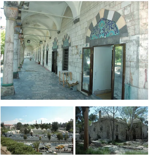
In 2000s the first part of the Complex that contains the Mosque and the Refectory was used as the Military Museum while the Madrasa and Arasta serve touristic souq. In the west of the Complex the National Archaeology Museum is located. The historic meadow (old Hippodrome) that is full of symbolic meanings located in the west of the Archaeology Museum has become an international fairground. Hamidiye Barracks that now belongs to the University of Damascus is located in the south-west; in the south-east the Mars Theatre and in the north-east the Ministry of Tourism are located (Figure 5-11).
CURRENT SPATIAL ORDER OF THE COMPLEX
The Friday Mosque and the Refectory, which constitute to the core of the Complex, are mentioned in the Contract of Foundation of Damascus Suleymaniye Complex dated to May 14th, 1557 however the Tabhane
(hospice) and the Caravanserai are not recorded. This is probably due to the fact that in the classical period, Imaret included an Aşhane (refectory) and a Caravanserai.
REPAIR PHASES OF SULEYMANIYE COMPLEX IN DAMASCUS METU JFA 2018/2 9
Figure 13. DSC a) Western gate (2009), b) Western gate, the courtyard facade (2005), c) Northern entrance and the single domed portico (2005), d) Eastern gate of the Arasta, 2009.
The first part of the Complex including the Mosque, Tabhane which is used for hosting the important guests, Caravanserai and Imaret are placed around a rectangular courtyard oriented on central north-south axis perpendicular to the River Barada (Figure 9- 12). Designed in the orthogonal courtyard order with three axes created by the Mosque and the
Imaret; Tabhane and twin Caravanserai blocks at both sides this building
complex shares the all features of 15th century Ottoman complexes. The
double centered planning formed by the Mosque and the Imaret placed oppositely also defines the functional hierarchy.
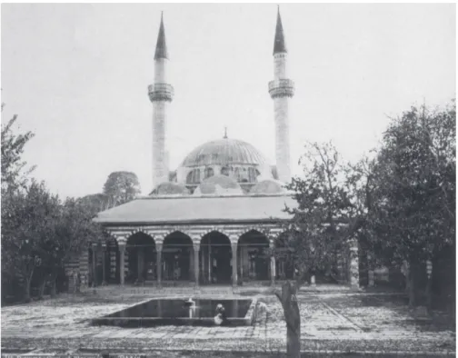
The service door to the north with its single domed portico that gives access to the courtyard of the Imaret and the ruins of a wooden bridge constructed on stone piers crossing the Barada can be seen in the photograph of 1868. During the landscape of the riverbank was reorganized and afforested between 1890 and 1900 a stone arch bridge with four bays was constructed Figure 12. Takiyah Mosque in 1870. [Source:
http://en.wikipedia.org/wiki/Tekkiye_ Mosque]. © Wikimedia Commons. Access date (09.05.2009).
aligned with the gate of the Imaret in the north. The bridge seen in the photograph published by Kuran in 1986 does not exist at present (Figure
5-6, 8, 13c).
The courtyard gate having a depressed arch made with dichromatic stones at the eastern side of the courtyard of the complex on the west entrance axis gives access to the Arasta. After this gate, there is the east gate of the Arasta ornamented with double rosettes made of dichromatic stone similar to the west gate of the courtyard in the photograph of 1868. The door opening with a depressed arched is located inside the relieving arch on the second layer of the outer surface of the gate (Figure 5-6, 8, 13d).
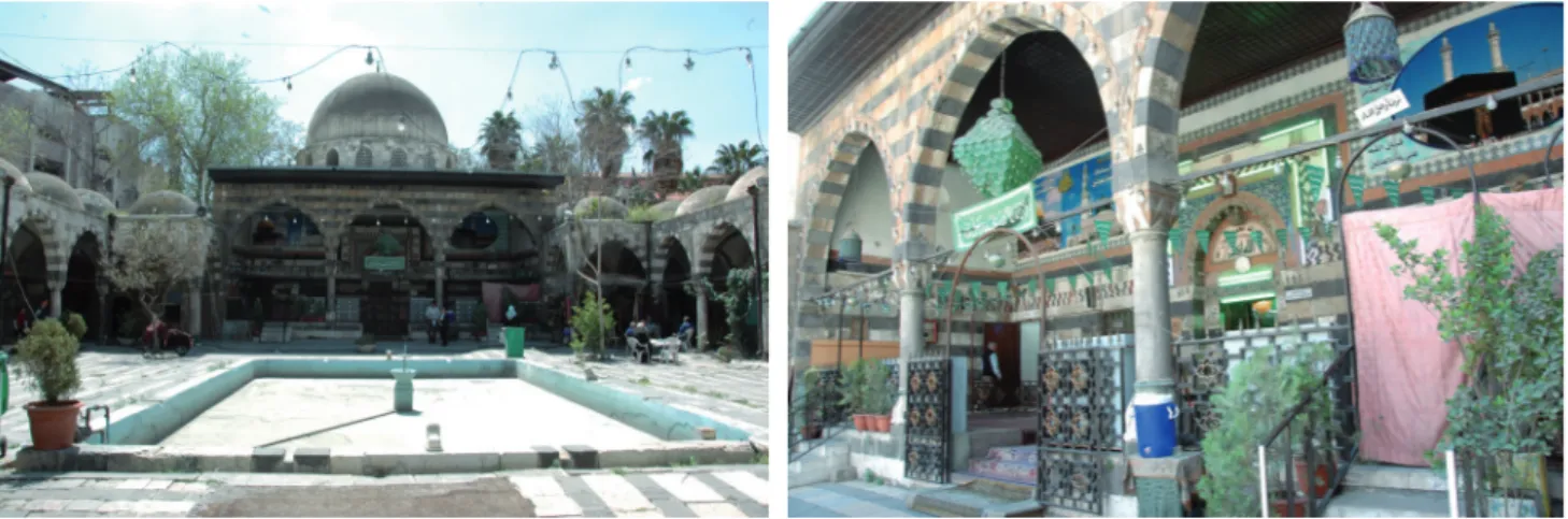
There is a shallow rectangular pool the edges of which is covered with dichromatic cut stone in the middle of the southern side of the courtyard, which is surrounded with the mosque and the porticoes of the Tabhane. Necipoğlu (2005, 229) argues that the fountain which allows coexistence of running water and still water symbolizes conciliation for the Hanafite and Shafii congregations inhabiting Damascus together (Figure 14).
The Mosque
The mosque at the centre of the Suleymaniye Complex is a plain, square planned, single domed structure with two minarets. Despite of its relatively small scale, it stands grandiosely in the courtyard with its double-naved narthex in the north of the Mosque. In the era it was constructed Aşık Mehmed, a geographer, described the mosque as one of the earliest examples expressing the Ottoman style in Damascus (Ak, 2007, 628). The main walls the thickness of which is about 104 cm are supported by the minarets located symmetrically in the two corners of the entrance facade and by corner buttresses at the mihrab facade (Figure 9- 12, 14- 16). The dome which is seated on a polygonal drum is supported by double flying buttresses located at each corner. There are twenty-four networked windows in total on the drum, five on each drum facade and one between the double flying buttresses. There is information in the registers of Istanbul Suleymaniye Complex on lead imported to be used in the superstructure of the Complex and especially of the Mosque (Necipoğlu, Figure 14. a) Süleymaniye Mosque and the
pool; b) Western façade of Süleymaniye Mosque, 2009.
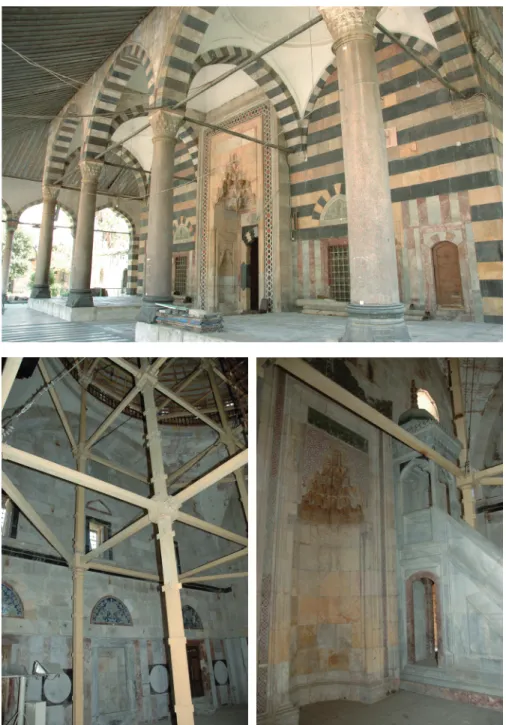
REPAIR PHASES OF SULEYMANIYE COMPLEX IN DAMASCUS METU JFA 2018/2 11 2005, 226). Presently the dome of the mosque is covered with lead similar to its original state while most of the domes in the Complex are plastered. The double minarets formed by conical caps, polygonal shafts and single balconies reinforce the symmetrical order of the Mosque. The entrance to the minarets is from the double-naved narthex.
At the northern entrance facade of the Mosque the double-naved narthex is located. The two external parts of the inner nave composed of four pillars are covered with domes, while the section where the entrance gate is located is covered with cavetto vault. There is an inscription panel on the arch states that the date of the completion of the complex was between 1558 and 1559 (Ak, 2007, 628) (Figure 15).
Figure 15. Süleymaniye Mosque, double naved narthex, 2009.
Figure 16. a) Interior space of Suleymaniye Mosque, eastern facade, b) Mihrab on the Kıbla wall of Süleymaniye Mosque, 2009.
Figure 18. Imaret a) View from north, the Caravanserai masses on sides, b) View from the inner garden in the north-eastern corner, 2009.
The other facades of the Mosque are less ornamented and built with black and white stones. There are totally six windows, two of which are in the lower row, three in the middle row and one in the upper row on the symmetrically configured eastern and western facades.
The interior of the Mosque which became out of service after 2002 due to its structural problems is quite plain too (Figure 16). The dome, which was renovated recently, is seated on the drum that is supported by high pendentives. It is plastered and white washed.
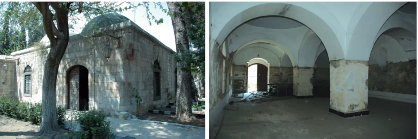
Tabhane
The Tabhane units that are constructed for the accommodation of some noble pilgrims alongside the Caravanserai are placed symmetrically on both sides of the Suleymaniye Mosque oriented in north-south axis. It is composed of six single domed square rooms arranged in a single row and in front of them a portico covered with domes at the courtyard facade. There is a wardrobe niche and a furnace in each room and the chimneys of furnaces rise above the dome level and are finished with conical caps. The main construction material used in the Tabhane blocks are yellowish-white fine cut stone. On the courtyard facades and vaults of the porticos black and white fine cut stones were laid alternatively. The columns of the porticos bear blue and red coloured diamond patterned capitals. The relieving arches on the windows and doors are decorated with patterned glazed tiles similar to those used in the Mosque. The interior walls of the
Figure 17. Portico of Tabhane in the west of the Mosque, view from north, 2009.
REPAIR PHASES OF SULEYMANIYE COMPLEX IN DAMASCUS METU JFA 2018/2 13
Figure 19. a) The eastern corner of Imaret facing towards the courtyard and the door leading to the rear courtyard, b) The facade of Imaret facing towards the courtyard with porticos, view from west to east, 2009.
Tabhane are plastered and the domes which were originally covered with
lead are now covered cement. The Tabhane has been abandoned since 2008 due to the renovation work (Figure 9-11, 17).
Imaret
The Imaret, which is placed to the north in the same axis with the Mosque, is a T shaped building block oriented in east-west direction. The northern side of the Imaret is bordered with a courtyard encircled with high walls that has a door opened to the Barada River. On the two sides the twin Caravanserais are located (Figure 9- 11, 18- 19).
The Imaret is formed by a cubical space in the centre and two domed spaces having individual entrances in both sides. They are linked with the courtyard at the south through a porch having twelve domes. The columns, column capitals and glazed tiles used above the openings of the portico continue the same decorative order with the Mosque and the Tabhane. The most important difference that the portico exhibits is the circular windows on the upper levels (Ak, 2007, 628- 9).
There are the large kitchen (matbah), a furnace, a dinner hall (ma’kel) and a pantry (kilar) in the Imaret. The kitchen is divided into four with a column
Figure 20. Imaret, the north-eastern corner of Aşhane space, 2009.
at the centre; the two spaces in the north are covered with a cross vault, while the other two spaces in the south are covered with two domes having lanterns on their tops (Figure 20).
In both sides of the refectory there are two square planned spaces covered with domes. The western unit of the refectory which had chimneys on its top according to the old photos should be the furnace. The single domed space located in the east side of the refectory is most probably the pantry. It can be deduced from the chimneys located above the eave level that there once have been hearts in the exterior spaces at both ends of the Imaret.
Caravanserai
The Caravanserai blocks are rather modest, rectangular buildings placed in the north-south axis in both sides of the Imaret. The twin Caravanserais which are connected symmetrically with the Imaret through the courtyard walls are divided longitudinally into two main naves with six piers located at the central axis and each nave is covered with seven small domes, supported with pendendives. Kuran (1986, 71) states that this double-naved configuration resembles the plans of Şehzade Mehmet Caravanserai and the Caravanserais of Gebze Çoban Mustafa Paşa Complex (Figure
9-11, 21).
There are small embrasures on the walls of the Caravanserais the entrance to which are from the courtyard of the Complex in the south. Although not recorded in the documents, there are fountains on the courtyard walls via which the Caravanserais are connected with the Complex. These fountains are currently non-functional.
The Madrasa
The “Taqqiyah” was inserted to the eastern end of the pedestrian way which intersects the Complex in east-west axis (Figure 9- 11, 22- 3). The Madrasa which has a symmetrical order that is defined by the classroom and a three domed portico at the axis of the entrance door is formed by the cells that surround the courtyard in three sides and the single naved and domed portico placed in front of them. The classroom, which is defined as
semahane by Aslanapa (1986, 236- 7) and as semahane and masjid by Kuran
(1988, 169), is located in the entrance in the north-south axis. The entrance to the Madrasa is from the Arasta through the main door located at the north. There is a rectangular pool similar to the one in the Suleymaniye Complex in the middle of the courtyard (Figure 23).
Figure 21. a) The courtyard entrance of Caravanserai block in the west of Imaret, view from south-eastern corner, b) View of the main entrance from the inside of Caravanserai block in the west of Imaret; windows faced to the courtyard on the left side and windows faced to outside on the right side, 2009.
REPAIR PHASES OF SULEYMANIYE COMPLEX IN DAMASCUS METU JFA 2018/2 15
Figure 22. a) View of the Classroom of Madrasa and the pool at the courtyard from the entrance, b) View of portico in front of the Classroom from west, 2009.
There are totally twenty-two cells, fourteen of which are in the east and west wings, six in the northern entrance and two in both sides of the classroom. The Madrasa cells which are connected with the courtyard via a door and a window are covered with domes, while the ones in the north-eastern and north-western corner attached to the Arasta are covered with flat roofs (Figure 24-25). At present the cells serve as handcraft goods shops and workshops.
While black and white stone elements are used alternately as
ornamentation in the stonework arches of the portico of the Madrasa, the facade of the narthex and the facade of the three domed entrance hall, the exterior facades of the building are decorated only with white stone. The original floor pavement of the portico of the Madrasa is black and white stone forming a large square encircling another smaller in a field bordered with columns. There is a significant threat of seating and collapse in the floorings of the courtyard and the portico which are paved almost in the same level.
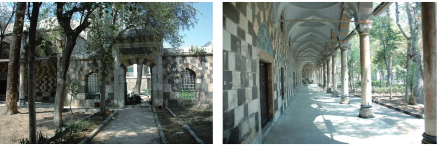
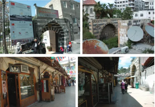
The Arasta
The Arasta is connected with the pedestrian walkway that intersects the Suleymaniye Complex in the east-west via a door. With a portal it is linked with Al Shaban Street in the east (Figure 9-11, 24-25). The Arasta is composed of twenty-three shops in two sides and two portals one in the south opens to the Madrasa and the other in the north to the front yard of the Ministry of Tourism building (Figure 24). There is a toilet which is a part of the original design of the Complex that can be reachable after
Figure 23. a) View of entrance portico of Madrasa from south, 2009, b) Portico of Madrasa, the collapse in the pavement at the west wing, 2005.
passing the Tabhane building. The portals of the Arasta which reflects the local traditions are decorated with dichromatic stone material.
THE REPAIR PHASES OF THE COMPLEX
The Suleymaniye Complex the first phase of which was completed in 1559 and the second in 1566 have undergone restorations and interventions due to natural disasters such as earthquakes, floods that took place in Damascus and functional needs. It is not possible to reveal the entire restoration history of the Complex in a period when the Ottoman resources were evaluated in rather limited degree. However, despite of these restrictions, a preliminary evaluation can be made with the aid of the information given in the sources or observable in the visual documents mentioned before as well as the traces in the buildings. Under the light of the information gathered within the scope of this study, the restoration interventions held in the Suleymaniye Complex can be separated chronologically into six main periods:
1. 19th century and before,
2. The period between 1915 and 1928, 3. The period between 1928 and 1960, 4. The period between 1960 and 1985, 5. The period between 1985 and 1990,
6. The period between 1990 and 2005/ present state.
19th Century and Before
As an important intuition of Ottomans in Damascus the Suleymaniye Complex which was visited by Aşık Mehmed in 1590s was a densely used social centre. The traveller while describing the features of the Complex with good impressions does not speak of any problem or restoration intervention (Ak, 2007, 364- 5).
Evliya who visited the city in 1648/1649 defines the Complex as a nice suburban recreation facility, describes the Green Maidan as a wandering place, but does not mention any structural problem (Dağlı et.al., 2005, Figure 24. a) Main East Gate of Arasta
leading to street, b) Intermediary gates of Arasta: the one on the left hand leads to the Ministry of Tourism in the north and the other on the right hand gives access to the Madrasa in the south, 2005.
Figure 25. a) The vaulted shops in the south-west of Arasta, b) Intermediary gate of Arasta gives access to the Madrasa in the south, 2009.
REPAIR PHASES OF SULEYMANIYE COMPLEX IN DAMASCUS METU JFA 2018/2 17 272). Their expressions are consistent with engravings of Damascus dated to 1575 and 1667, in which the bank of River Barada the caravans in the Green Maidan people fishing and resting are depicted together with the Suleymaniye Complex outside the city walls (Figure 1-2).
According to the written sources, the earliest restoration was done after the earthquake of 1759 that caused terrible devastation in Damascus. Ertaş (2005, 2-9) in his study, which is based on the inventory books the Royal Head Architect Ahmed Ağa’s inspection and post-restoration reports located in the Ottoman Archives, mentions the partial restoration and interventions in the Suleymaniye Complex. According to this study, in the restoration work that was completed in 1762, all the buildings except the Mosque underwent an extensive restoration work including the renovation of the domes, masonry walls and lead sheet coverings as well as the changing of window and door frames and glasses. Another contribution that Ertaş (2005, 7-8) provides is that the masonry piers and roofs of the wheat and flour silos in the Green Maidan were restored. The building masses that are seen adjacent to the courtyard wall near the western entrance of the Complex in the original design of the building and in certain 19th century visual documents must be these silos. Although not any
new document about the restoration implementations in the Suleymaniye Complex were discovered, it is reasonable to think that since building complex served for the pilgrims, its maintenance should have been held periodically, meaning that it should have been exposed to previous restoration interventions.
The Period between 1915 and 1928
During its final years, the Ottoman State accelerated construction and building maintenance and repair activities in its territories in the Middle East and Arabia, which soon were to be separated from the imperial realm. In his study, where he describes this period in detail, Cengizkan (2009, 184) states that the policies implemented in the provinces of the Middle East and Arabia within the frame of Panislamism had an aim of awakening positive emotions in Arab society towards the Ottoman State.
Cengizkan (2009, 179) also mentions that within the scope of the reforms of the Second Constitutionalist Period, certain improvements were made in Vakıf İdaresi (Administration of Pious Foundations) including establishment of İnşaat ve Tamirat Müdürlüğü (the Directorate of Construction and Renovation) in order for maintenance and repair of buildings owned by Pious Foundations and assignment of Mimar Kemalettin as the first director to this institution. Mimar Kemalettin selected his co-workers upon an examination and established Heyet-i Fenniye (the Scientific Board), of which Mehmet Nihat was also a member, in 1909.
The lavishness of Ottoman Government regarding its investments in these lands that were going to be lost soon is attention-grabbing. Mimar Kemalettin and Mehmet Nihat followed this idea with heart and soul. The perspective of Vakıflar İdaresi, which was one of the most influential institutions in the final years of the Ottoman State, can be understood from architect Mehmet Nihat Nigisberk’s memories of the period presented in Cengizkan’s study (2009, 177-208). The repair activities conducted in Suleymaniye Mosque, Suleymaniye Madrasa and Imaret are described in these memories thoroughly (2009, 187- 90).
Before commencing repair works, Nigisberk identified the problems in the mosque and madrasa, made a program and then realized repair interventions accordingly. In the Suleymaniye Mosque, the ashlar masonry walls of the building were repaired; after checking the separating piers, the window openings on its dome were cleared to provide light to interior space. In the Madrasa, columns, column capitals and arch stones were repaired and the flooring and domes of the building were renovated. In imaret, separating walls were reconstructed and main walls were repaired. The stucco windows were produced in Istanbul. After producing the inner and outer grills of the windows on the skirts of the domes of the mosque and Taqiyyah, the windows on the mihrab wall and side windows of Suleymaniye Mosque were produced. It is clear that an extensive repair and maintenance activity was conducted in the Complex in this period. Because of his health problems, Nigisberk needed to transfer his mission of repairing Suleymaniye Mosque, Selimiye Madrasa and Imaret in Damascus to Reşid Bey with very few incomplete items, and left for Istanbul.
Meanwhile, the war was in progress in Syria and Arabia with unabated (Cengizkan, 2009, 190).
The Period between 1928 and 1960
The investigation of the partial French projects belonging to certain sections of the Complex and photographs from the years of 1929, 1930 (or 1938) and 1949 in the Museum of Historical Documentation of the Directorate of Ancient Monuments, which is a branch of Syrian Ministry of Culture, reveals that the building complex was documented and partially restored during the French Mandate period (1928-1946). Among these documents, the unscaled drawing of 1924 including the entire building complex and titled as the Suleymaniye Complex and Selimiye Madrasa is the same with the ones in Wulzinger and Watzinger (1924), Kuran (1986) and Aslanapa (1986). The shops in the north-eastern wing of the Arasta are not indicated in this drawing.
Although the Restoration Project of the Madrasa, which was prepared by Syrian Ministry of the Public Works in 1929 barely indicates the details, it is still be observable that some chimneys which did not exist in that era were added to the roof plan (Şahin Güçhan and Kuleli, 2009, 176-7). On the other hand, in an archive photo, which is according to Syrian authorities dated to pre 1960, in addition to the roof of the Madrasa, chimneys in western and eastern wing of the Arasta can easily be seen (Figure 26). In the same photo, the shops in the north-eastern wing of the Arasta are demolished compare to Figure 10. In the photo of 1924 published by Wulzinger and Watzinger, only two of the Madrasa cells have chimneys. Therefore, the cell chimneys which seem intact today must have been built in a later period according to the project prepared by French in 1929.
In the project of Restoration of Minarets of Takiyya Suleymaniye (1930-1938?) which is included in the aforesaid archive, plan of the Mosque and section drawings of the dome and minaret exist (Figure 27). These probably are from before 1924. In this project, only restoration of the minaret in the north-east side was planned. Indeed, the photographs, which are dated to 1960s, indicate that the minaret in the north-eastern side of the Mosque was demolished to the level of the drum of the dome of the Mosque and rebuilt (Figure 28).
In the Restoration Project of 1949, prepared by the Ministry of Public Works of Syria, which includes the 1/100 scaled plans of the Madrasa and
REPAIR PHASES OF SULEYMANIYE COMPLEX IN DAMASCUS METU JFA 2018/2 19
Figure 26. a) View of Süleymaniye Madrasa from west, b) The west wing of the portico of Süleymaniye Madrasa (The Archive of Syrian Ministry of Culture).
Arasta, the drainage system for the building and surroundings is given. The project anticipated the discharge of the water accumulating in the exterior periphery of the Madrasa and the Courtyard to Barada River via canals made of concrete. The users of the building stated that this project was applied in following years but the canals stopped working in 2000s. As mentioned in the memories of Mehmet Nihat that the Madrasa was flooded and in order to solve this problem, construction of drainage canals was suggested; there was a recursive flooding problem due to ground water at this spot (Cengizkan, 2009, 187).
The Period between 1960 and 1986
Although Rihawi mentions that the Suleymaniye Complex was restored in 1960s by the Directorate of Ancient Monuments, any project related to this restoration implementation was found in the archive (4). This situation suggests that a part of the restorations was planned in the French Period Figure 27. The Restoration Project for the
Minaret of the Takiyah of Sultan Süleyman, Damascus, a) Plan of the Mosque, b) Section Drawings of Minaret and Dome, 1930 or 1938, (Archive of Syrian Ministry of Culture). 4. The short introductory text in ARCH NET about the Damascus Suleymaniye Complex based on Q. Rihawi reveals that the Complex was entirely restored in 1960s; see: http://archnet.org/library/sites/one-site. tcl?site_id=6883, accessed in 22/09.2009. Also see: (Rihawi, 1979).
(1930-1938?); however, applied after 1960. Several photographs from 1960s also indicate that the Suleymaniye Mosque and demolished minaret in the north-east was intervened in this period (Figure 28, 29).
In this period, a scaffold was set up in the southern facade of the Mosque. Since the facades were intact, the scaffold must have been built to reach the superstructure or the dome drum. According to a series of photographs, which shows the restoration implementation of the demolished minaret in the north-east, the minaret was rebuilt by covering a reinforced concrete cylinder with stone; the elements in the stone masonry were affixed with iron clamps into each other in the traditional way. Besides, the foundation of the minaret was enforced with iron fittings.
The photograph dated to 1962 in Syrian Ministry of Culture, Museum of Historical Documentation shows the destruction in the northern service entrance of the Imaret caused by a truck (Figure 29b).
Aerial photographs indicating the Complex and its environs’ status in 1960s should be contemporaneous with those (Figure 8) which were published by Aslanapa (1986:236), Kuran (1986:69-70) and Şahin Güçhan and Kuleli (2009, 38-9).
In these photographs, the green veil in the courtyard partially covers the building facades. The chimneys in the Madrasa are not completed yet and the courtyard of the Imaret, which seems ragged, is paved with a rigid material. In front of the northern gate of the Imaret, there is a stone bridge, which is missing today. In the riverside of Barada, a wall and a drive way had been built.
Figure 29. a) Repair works in Süleymaniye Mosque, southern facade, early 1960s, b) The damage made by a truck at the northern entrance of the Imaret courtyard, 1962 (The Archive of Syrian Ministry of Culture). Figure 28. a) Scaffold set up for repair of the north-eastern minaret of Süleymaniye Mosque, b) Workmen working in the minaret of the Mosque, early 1960s, (The Archive of Syrian Ministry of Culture).
REPAIR PHASES OF SULEYMANIYE COMPLEX IN DAMASCUS METU JFA 2018/2 21 In the photograph in the Archive of the Museum of Historical
Documentation of the Ministry of Culture of Syria that was taken from the north of the Complex in 1960s, the Mosque, Imaret and Tabhane seems intact, although the trees have grown up so as to cover the facades of the buildings. The construction works at the southern edge have almost been completed and the roads and public squares around the Complex were arranged. The street in the north, next to the Barada River has been expanded. The pedestrian bridge in the north of Imaret which spans the River Barada is missing. The pavement of the river has been changed and newly added trees have grown up rapidly. Although the Madrasa is not entirely seen in the photograph, the Complex seems well maintained and intact (5) (Figure 5).
The Period Between 1985 and 1990
A series of photographs taken in 1985, 1986 and 1990s are accessible for the use of researchers in the archive of ARCHNET. When these photographs are studied, it can be seen that the Complex was in good condition in the years of 1985 and 1986 (6). Especially the photographs, belonging to 1985, show that the floor of the courtyard of the Madrasa has not any deformation (7). The visual documents from the years between 1980 and 1990 reveal that the Suleymaniye Complex and the Madrasa were structurally in good condition during that period. According to these documents, the Mosque was open for use and its interior was carpeted. On the other hand, the Complex with all of its divisions was being used as an urban social space.
The Period Between 1990 and 2005 and the Current Situation
The Madrasa and Mosque divisions of the Suleymaniye Complex in Damascus, which maintained its spatial qualities and reached to present time, face with structural problems in 2000s due to some reasons such as the increase of ground water level and malfunction of the drainage system. For the protection of the Complex, Syrian authorities cooperate with UNESCO. Meanwhile certain interventions to prevent the damage in the Madrasa are also held.
In order to prevent further damages in the dome and disintegrations in the south and west walls of the Mosque, which is caused by collapses in the floor, the south and west walls of the building were enclosed within steel beams and profiled iron bands and a temporary support scaffold was installed inside the building (Figure 30). On the other hand, the damaged walls of the Mosque were tried to be reinforced by injecting great amount of cement mortar inside them via small holes of 3-4 cm in diameter (Figure
31). However, according to the local authorities, after this application,
disintegrations and inflations occurred on the wall surfaces. Within this course, no structural intervention was held in the Imaret, Tabhane and Caravanserai units which did not have any important problem, but the stone masonry walls of the buildings underwent pointing with cement based mortar. The interior spaces were plastered with similar mixtures and majority of the window and door frames were renewed.
Although the pool and the floor pavement in the courtyard remained mostly in their original states, due to the elevation of the levels of the streets around the Complex, the courtyard level as well as the main entrances became approximately one meter below the street level. So as to solve this problem, staircases were added in the entrances of the Complex. 5. A series of photographs located in
the Creswell Archive of the Ashmolean Museum that show the condition of the Suleymaniye Complex in Damascus after 1960s is accessible for the use of researchers in the ARCHNET Digital Library: http:// www.archnet.org/lobby/ via following item numbers: ICR2587; ICR2588; ICR2583; ICR2584; ICR2583; ICR2590; ICR2592 and ICR2591, 22/09.2009.
6. They are accessible on: http://www.archnet. org/lobby/, accessed in 22/09.2009.
7. The photograph no ISY0427 is accessible on http://www.archnet.org/lobby/, accessed in 22/09.2009.
In 2000s, the changes in the ground of the Complex caused great
damage in the Mosque and the Madrasa. Collapse in the ground affected especially the north and north-eastern wings, the courtyard and the portico of the Madrasa causing instability in the superstructure, cracks and disintegrations. The west wall slightly shifted from its axis. There have been vital subsidence and collapses in the stone paved ground of the courtyard too. A temporary measure was taken by building a buttress at the facade of the entrance portico which faces to the courtyard (Figure 32). These problems in the Madrasa caused structural problems in the Arasta; fractures and disintegrations occurred in some of the doors and the shops in the Arasta.
CONCLUSION
Suleymaniye Complex in Damascus was designed by Royal Head Architect Sinan in compliance with the basic principles of Ottoman classical
architecture and built between 1554 and 1559 as a foundation building. The institution of pious foundations has been one of the most influential factors in formation and continuation of buildings of Anatolian-Turkish art since the appearance of this art (Madran, 2004, 41). With the aim Figure 30. a) Steel framework system
supporting the dome of Süleymaniye Mosque,b) Metal supports at the southern (kıbla) wall of the Mosque, 2005.
Figure 31. Holes for injecting mortar on the interior walls of Süleymaniye Mosque, 2005
REPAIR PHASES OF SULEYMANIYE COMPLEX IN DAMASCUS METU JFA 2018/2 23
of sustainability of these buildings, Ottomans produced vakfiyes (foundation inscriptions), documents which include information on the administration of the foundation, its income sources and the methods for repair and maintenance, during the construction phase of foundation buildings. Madran (2004, 45) states that legal, administrative, technical and monetary affairs, which covered identification of repair needs of foundation buildings, decision of repair, completion of repair activities and vindication of responsible bodies, constituted the course of repair. Repair implementations were conducted after completing these processes and providing necessary labour force and financial sources. Investigations on primary and secondary estimations offer a detailed picture of the place, scale and nature of interventions made on the building.
In this regard, it is safe to say that the most reliable sources considering the construction interventions held in the Ottoman Era were the construction records that are kept in the Ottoman archives. It would be possible to bring about better evaluations about the repairs in the Complex in case these documents are retrieved and studied.
It is deduced from the documents retrieved from the literature reviews and archival studies that the Suleymaniye Complex had been used as a social centre from the first day it was opened and the repairs were conducted in accordance with the conditions of the era under the Ottoman rule, French mandate and Syrian Government. Indeed, in 2005 the Syrian Government demanded support for collaboration with the team of experts from Turkey when needed, considering the repair of the Complex.
The course, which started in 2005 when the Republic of Turkey joined actively in the conservation works in the Suleymaniye Complex in Damascus, became solidified with the memorandum of April 2007 signed between two countries. According to this memorandum, Turkey has took the responsibility of the restoration of the Suleymaniye Complex and in order to obtain the project, launched research and restoration activities proposed by different teams including the authors of this paper. Within Figure 32. Supporting scaffold at the
this framework, by March 2009, structural monitoring and investigations in the Complex were substantially completed; as a result of the tender launched, measured drawings, restitution and restoration projects of the building complex were prepared and endorsed by Turkish Ministry of Culture and Tourism, the General Directorate of Foundations, TİKA (Turkish Cooperation and Development Agency) and Syrian Ministry of Foundations. However, started in March 2011, the war has been hampering all these co-operative attempts between two countries. Unfortunately, there is no any information regarding the current status of the complex.
BIBLIOGRAPHY
ARCHNET (2009) Digital Library. [http://www.archnet.org/library] Access Date (23.09.2009).
AK, M. (2007) Menâzırü’l-Avâlim: tahlil metin, Âşık Mehmed, (Ankara, Türk Tarih Kurumu Publications, Dizi-Sa.27, 3 Vol. 364-5.
ASLANAPA, O. (1986) Osmanlı Devri Mimarisi, İstanbul, Anka Ofset A.Ş. BRAUN, HOGENBERG , (1575) Civitates Orbis Terrarum, Cologne, 1575,
Braun and Hogenberg, Civitates Orbis Terrarum, map II-55, [http://
historic-cities.huji.ac.il/syria/damascus/maps/braun_hogenberg_ II_55.html] Access Date (15.11.2005).
CENGİZKAN, A. (2009). Mimar Kemalettin ve Çağı: Mimarlık/ Toplumsal
Yaşam/ Politika, Mehmet Nihat Nigisberk’in Katkıları: Evkaf İdaresi
ve Mimar Kemalettin. Fayton Tanıtım, Ankara.
T.F.L. (1929) Bureau Topographique des Troupes Françaises du Levant,
Damas map 1929, Paris, Service Géographique de l’Armée, January
1929, [http://historic-cities.huji.ac.il/syria/damascus/maps/tfl_1929_ damascus.html] Access Date (15.11.2005).
DAPPER, OLFERT (1677) Naukeurige beschryving vangantsch Syrie, en
Palestyn of Heilige Lant.., Jacob van Meurs, Amsterdam, sf. 17. 1677, Olfert Dapper, Naukeurige beschryving van gantsch Syrie..., [http://
historic cities.huji.ac.il/syria/damascus/maps/olfert_dapper_1677_ damascus.html], Access Date (15.11.2005).
DÜNDAR, A. (2000) 16. Yüzyılda Suriye, Mısır ve Suudi Arabistan’daki İmar ve İnşa Faaliyetlerine Katkıda Bulunan Bazı Osmanlı Mimarları,
Ortadoğu’da Osmanlı Dönemi Kültür İzleri Uluslar Arası Bilgi Şöleni Bildirileri, 25-27 Ekim 2000, [http://www.akmb.gov.tr/turkce/books/
osmanli/a.dundar.html], Access Date (15.11.2005).
ERTAŞ, M. Y. (2000) 1789 Şam Depremi’nde büyük hasar gören Emeviye, Selimiye ve Süleymaniye camilerinin onarımı, Ortadoğu’da Osmanlı
Dönemi Kültür İzleri Uluslar Arası Bilgi Şöleni Bildirileri, 25-27 Ekim 2000, [http://www.akmb.gov.tr/turkce/books/osmanli/m.ertas.html],
Access Date 15.11.2005.
KAFESÇIOGLU, Ç. (1999) In the Image of Rum: Ottoman Architectural Patronage in Sixteenth Century Aleppo and Damascus, Muqarnas, no: XVI, 70-96.
KURAN, A. (1986) Mimar Sinan, İstanbul, Hürriyet Vakfı Publications. KURAN, A. (1988) Şam Süleymaniye Külliyesi, Mimar Sinan Dönemi Türk
DAĞLI, Y., KAHRAMAN, S. A., DANKOFF, R. (2005). Evliya Çelebi
Seyahatnamesi, Topkapı Sarayı Kütüphanesi Bağdat 306, Süleymaniye
Kütüphanesi Pertev Paşa 462, Süleymaniye Kütüphanesi Hacı Beşir Ağa 452 Numaralı Yazmaların Mukayeseli Transkripsiyonu-Dizini, Der. KOZ, M.S. Cilt: 9, Yapı Kredi Yayınları 2173, İstanbul.
MADRAN, E. (2004) Osmanlı İmparatorluğunun Klasik Çağlarında Onarım
Alanının Örgütlenmesi:16-18. Yüzyıllar, ODTÜ Mimarlık Fakültesi
Basım İşliği, Ankara.
NECIPOĞLU, G. (2005) The Age of Sinan: architectural culture in the Ottoman
Empire, Princeton University Press, Princeton.
ÖNEY, G. (2000) Şam Tipi Adını Alan İznik Seramikleri, Çinileri ve Şam Örnekleri, Ortadoğu’da Osmanlı Dönemi Kültür İzleri Uluslar Arası Bilgi
Şöleni Bildirileri, Ekim 2000, Hatay, [http://www.akmb.gov.tr/turkce/
books/osmanli/m.ertas.html] Access Date (15.11.2005).
RAYMOND, A. (1985) Grandes villes arabes á l’époque ottomane, Osmanlı
Döneminde Arap Kentleri, çev. Ali Berktay. (1995) Tarih Vakfı
Yayınları, Numune Matbaacılık, İstanbul.
REMONDINI, G. A. (1675). Noe Bianchi, 1675, G.A. Remondini Viaggio da Venetia al St. Sepolcro...ed al Monte Sinai, con disegno delle Citta, Castelli, Ville, Chiese, Monasteri, Isole, Porti e Fiumi. [http://historic-cities.huji.ac.il/syria/damascus/maps/bianchi_remondini_1675_ damascus.html] Access Date (15.11.2005).
RIHAWI, A. Q. (1979) Arabic Islamic Architecture in Syria. Damascus: Ministry of Culture and National Heritage, 239-47.
ŞAHIN GÜÇHAN, N., KULELI, A. E., (2009) Şam Süleymaniye Külliyesi ve
Koruma Sorunları, Vakıflar Genel Müdürlüğü Yayınları, İstanbul.
TURAN, Ş. (1963) Osmanlı Teşkilâtında Hassa Mimarları, AÜDTCF Tarih
Araştırmaları, Yıl 1, Sayı: 1 (ayrı basım), 1-47.
VAN LEEUWEN, R. (1999) Waqfs and Urban Structures: the Case of Ottoman
Damascus, Koninklijke Brill NV, Leiden, The Netherlands.
WULZINGER, K., WATZINGER, C. (1924) Damascus, Die Islamische Stadt, Walter De Gruyter& Co, Berlin und Leipzig.
YÜKSEL, İ.A., (1983) Osmanlı Mimarisinde II Beyazid Yavuz Selim Devri
(886-926/1481-1520), Cilt V., İstanbul Fetih Cemiyeti Yayını, 83. Kitap,
İstanbul
ABBREVIATIONS:
DSC Damascus Suleymaniye Complex
ASMofC The Archive of Syrian Ministry of Culture
ŞAM SÜLEYMANİYE KÜLLİYESİ’NİN ONARIM EVRELERİ
Balkanlardan Mekke’ye uzanan hac yolu üzerinde, Şam’ın Barada Nehri kıyısında, çölden önceki son durak noktası olarak inşa edilen Şam Süleymaniye Külliyesi, Hassa Mimarbaşı Sinan’ın Osmanlı klasik dönem mimarisinin temel ilkelerine göre tasarladığı, 1554–59 yılları arasında inşa edilen eserlerinden biridir.
“Süleymaniye Tekkesi” olarak da bilinen cami, çifte tabhane ve
kervansaraylar, imaret, medrese ve arasta yapılarından oluşan külliyenin tarihi ve mimari özellikleriyle ilgili bugüne kadar pek çok araştırma yapılmış olup, bu araştırmalar külliyenin özgün niteliklerini ve inşa aşamalarını aktarır. Kaynaklara göre Külliyenin cami, tabhane ve imaretten oluşan ilk aşaması 1559’da, medreseyi içeren ikinci aşaması ise 1566’da tamamlanmış; 1567-1596 arasında bu yapı grubuna bir de Derviş Dergâhı eklenmiştir. Günümüze ulaşamayan bu dergâhın konumu bilinmemekle birlikte, arasta ile Barada Nehri arasında olması beklenir.
Halen 16. yüzyıldaki özgün niteliklerini koruyan Külliyenin ilk aşaması, gerek mimari düzeni gerekse yapım tekniği açısından Şam’daki en önemli Osmanlı eserlerinden birisidir. İkinci aşamada inşa edilen Medrese planimetrik özellikleriyle Mimar Sinan’a atfedilmekle birlikte; mimari elemanları ve inşa tekniğindeki ayrıntılarıyla Şam’a ait yerel özellikler taşır. Âşık Mehmed’in 1590’lı yıllarda ziyaret ettiği Süleymaniye Külliyesi yoğun kullanılan, dolayısı ile iyi işletilen ve yapısal açıdan da iyi durumda bir sosyal merkezdir. 1648-1649’da Şam’a giden Evliya Çelebi de Külliyeyi sayfiye yeri benzeri, hoş kırsal bir dinlenme yeri, hatta çöle gelmeden önceki son vaha olarak tanımlar. Bu seyyahların aktardıkları bilgiler, 1575 tarihli Braun ve Hogenberg ile 1667 tarihli Olfert Dapper’in Şam gravürlerinden de okunur.
Külliye ile ilgili bilinen en eski onarım, Şam’da büyük yıkıma yol açan 1759 depreminden sonradır. Deprem sonrası Şam’da yapılacak onarımlara ilişkin keşif ve harcama kayıtlarından Külliyenin hangi bölümlerinde onarım yapıldığı anlaşılmaktadır. 1836 yılına ait Bartlett gravürüyle, 19. yy sonu ve 20. yy başına ait fotoğraflarda Külliyenin çevresi tümüyle boş, bir sayfiye alanı görüntüsündedir. Cengizkan’ın çalışmasında, Osmanlının son yıllarında, 1915-1928 yılları arasında Devlet topraklarından kısa sürede ayrılacak olan Orta Doğu ve Arabistan Yarımadası’nda, inşaat ve bakım-onarım çalışmalarına hız verildiği bildirilir. Cengizkan tarafından yayınlanan Mimar Mehmet Nihat Nigisberk’in bu döneme ait anılarında, Süleymaniye Câmii, Süleymaniye Medresesi ve İmâreti’nin onarımına ilişkin yapılan onarım çalışmaları ayrıntılı olarak tariflenmiştir.
Ancak Şam’ın 1930’larda başlayan ve 1960’lardan sonra artan büyümesi, mekânsal düzeni ve özgün işlevini koruyan Külliyenin yakın çevre ilişkilerini değiştirmiştir. Bu süreçte bir kent içi külliyesine dönüşen Süleymaniye Tekkesi; Şam’da meydana gelen deprem ve sel gibi afetlerden etkilenmiş; güncel gereksinimlere göre farklı dönemlerde çeşitli onarımlar geçirmiş ve özellikle son otuz yılda, Barada Nehri kıyısındaki alanlarda zemin suyu seviyesinin düşmesi sonucunda, ciddi yapısal sorunlarla karşı karşıya gelmiştir.
Bu çalışma, arşiv ve literatür araştırma sonuçları ile yapılardaki tespit ve izleri ilişkilendirerek, Külliyenin inşa ve onarım aşamalarını, ilk yapım tarihinden itibaren 6 dönem halinde kronolojik bir düzen içinde dönemlere ayırarak incelemeyi ve son yayınlardan da yararlanılarak varılan sonuçları uluslararası platformda paylaşmayı amaçlar. İlk beş dönemdeki onarım Alındı: 09.02.2016; Son Metin: 03.11.2017
Anahtar Sözcükler: Şam Süleymaniye Külliyesi; Mimar Sinan; Osmanlı; restorasyon.
ve müdahalelerle ilgili değerlendirmeler, bulunabilen sınırlı bilgi ve görsel belgeyi esas alırken; 2005 yılındaki duruma ilişkin tespit ve değerlendirmeler yazarların yaptıkları gözlem ve arşiv araştırmalarına dayanır. Bu çalışmanın, 1554 yılında Mimar Sinan’la başlayan tasarım aşamasından günümüze, eserdeki değişimlerin izlenmesine katkısının yanı sıra; farklı dönemlerdeki yapı üretim ve müdahale süreçlerinin anlaşılmasına yardımcı olması beklenmektedir.
REPAIR PHASES OF SULEYMANİYE COMPLEX IN DAMASCUS Süleymaniye Complex in Damascus, built on the bank of Barada River as
the last stop before the desert on the pilgrimage route extending from the Balkans to Mecca, is one of the works of Hassa Chief Architect Sinan, which was designed according to the basic principles of the Ottoman classical period architecture, and built between 1554 and 1559.
Many research has been carried out on the historical and architectural features of the complex, which is composed of the mosque that is also known as the “Takiyah Süleymaniye”, double tabhane (hospice) and
caravanserais, imaret (soup kitchen), madrasa and arasta (bazaar) structures and these investigations focused on the original qualities of the mosque and its construction phases. According to the sources, the first phase of the Complex consisting of the mosque, tabhane and imarethane was completed in 1559 and the second phase including the madrasa was completed in 1566, later on, between 1567 and 1596, a Dervish lodge was added to this building group. Although the location of this dervish lodge, which has not reached the present day is unknown, it is anticipated that it was located in the area between the arasta and Barada river.
Preserving its original characteristics in the 16th century, the first stage of
the Complex is one of the most important Ottoman works in Damascus, both in terms of its architectural layout and construction technique. Although the Madrasa built in the second phase is attributed to Mimar Sinan due to its planimetric features, it resembles local characteristics of Damascus with its architectural elements and details in the construction technique.
Süleymaniye Complex, which was visited by Aşık Mehmed in the 1590s,
was a frequently used, and therefore a well-run social center in good structural condition. Evliya Çelebi, who went to Damascus in 1648-1649, defines the Complex as a pleasant rural retreat and even as the last oasis before the desert. Information from these travelers is also supported by the engravings of Damascus by Braun and Hogenberg, dated to 1575, and by Olmert Dapper, dated to 1667.
The oldest known repair of the Complex took place after the earthquake of 1759, which caused massive destructions in Damascus. The repaired parts of the Complex can be identified from the records of exploration and expenditures related to the repairs carried out in Damascus after the earthquake. The Bartlett engraving of 1836 and the photographs from the end of the 19th century and the beginning of the 20th century show that
the surroundings of the Complex were completely empty, like a summer resort area. In the work of Cengizkan, it is reported that in the last years of the Ottoman Empire, in a short period of time between 1915 and 1928, the construction and maintenance-repair works accelerated in the Middle East and the Arabian Peninsula, which would be separated from the state territory. In the memorials of this period written by Architect Mehmet
METU JFA Advance Online 27 REPAIR PHASES OF SULEYMANIYE COMPLEX IN DAMASCUS
Nihat Nigisberk, published by Cengizkan, the repair works of Süleymaniye
Mosque, Süleymaniye Madrasa and Imâret were described in detail.
However, the growth of Damascus, started in the 1930s and increased after 1960, changed the close relations of the Complex with its environment even though it maintained its spatial arrangement and original function. The whole Complex, locally called as Takiyah Süleymaniye, which became part of the urban inner city during this period, was affected by disasters such as earthquakes and floods happened in Damascus. It has also undergone various repairs at different times according to contemporary needs and has faced serious structural problems, especially in the last thirty years, as a result of decreasing ground water level in the areas along the Barada River. This work aims to analyse the construction and repair phases of the Complex by classifying them into six chronological periods starting from its construction and to share the results obtained from recent publications by associating the findings and traces from the buildings with the historical documents and investigations in the international platform. While the evaluations on the repairs and interventions in the first five periods are based on the limited information and visual documentation where available, the assessments of the condition of the Complex in 2005 are based on field observations and archive research made by the authors. Along with contributing to the monitoring of changes took place in the Complex from its design phase that started with Mimar Sinan in 1554 until present day, it is also expected that this work would help in understanding the processes of building production and interventions in different periods.
NERİMAN ŞAHİN GÜÇHAN; B.Arch., M.Arch., PhD.
Received her B.Arch. from Middle East Technical University in 1983 and her M.Arch. from the same university in 1986. Earned her PhD. degree in architectural conservation from METU in 1995. Her areas of interests and research topics include preservation and rehabilitation of historic sites, conservation management planning, restoration projects of historic monuments and traditional old houses, conservation of timber framed historic houses, historic structural systems/materials and their decay, conservation education, accreditation of architectural education, Ankara, Southeast Anatolia Project (GAP), Nemrut Tumulus, Adıyaman, Old Greek settlements in Anatolia.
AYŞE ESİN KULELİ; B.Arch, M.Sc., PhD.
Received her B.Arch from Selçuk University in 1984 and MSc. in architecture/restoration from Dokuz Eylül University, Faculty of Architecture in 1998. Earned her PhD. degree in architec-ture from the Post Graduate Program in Restoration at Dokuz Eylül University (2005). Major research interests include documentation, surveying, historical researches, technology of tra-ditional materials, developing conservation interventions for historic structures and manage-ment of historical sites. [email protected]